

Introduction
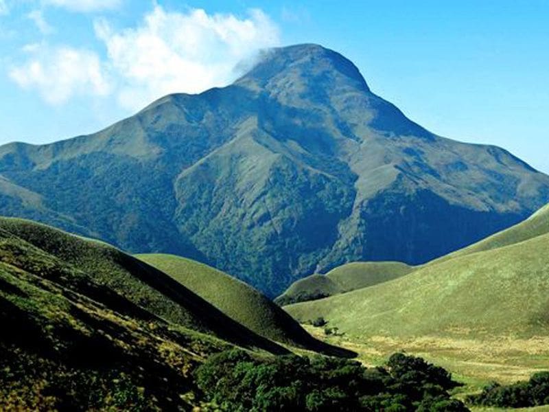
Kerala is blessed with the magnificent Western Ghats, a mountain range known for its rich biodiversity, evergreen forests, tea plantations, mist-covered peaks, and spectacular hill stations. From Anamudi, the highest peak in South India, to the rolling hills of Wayanad and the scenic highlands of Munnar, Kerala’s mountains play a vital role in the state’s climate, rivers, agriculture, tourism, and wildlife conservation.
This collection of 100 General Knowledge (GK) questions covers Kerala’s famous mountains, highest peaks, hill stations, mountain passes, forests, wildlife habitats, and geographical features. It is useful for students, teachers, competitive examinations, quiz competitions, and general knowledge enthusiasts.
Section 1: Basic Knowledge About Kerala Mountains
- Which major mountain range runs along the eastern side of Kerala?
- What is the highest mountain peak in Kerala?
- What is the highest peak in South India?
- In which district is Anamudi located?
- What is the approximate height of Anamudi above sea level?
- Which mountain range is recognized as a UNESCO World Heritage Site for its biodiversity in Kerala?
- Which Kerala district is especially famous for its mountain landscapes and hill stations?
- Which mountain range forms a natural boundary between Kerala and Tamil Nadu in many areas?
- What is the general direction of the Western Ghats along Kerala?
- Why are Kerala’s mountains important to the state’s climate?
Section 2: Anamudi and Other Famous Peaks
- Which is the highest peak in the Western Ghats?
- What does the name “Anamudi” mean in Malayalam?
- Near which famous hill station is Anamudi situated?
- Anamudi lies within which national park?
- Which mountain peak in Kerala is famous for its resemblance to the shape of an elephant’s head?
- Which is one of the most famous high-altitude peaks in the Wayanad region?
- What is the approximate height of Chembra Peak?
- In which district is Chembra Peak located?
- Which famous heart-shaped lake is associated with the trek to Chembra Peak?
- Which peak is a popular trekking destination near Munnar and is associated with the Eravikulam region?
Section 3: Munnar and the High Ranges
- In which district is Munnar located?
- At the confluence of which three mountain streams is Munnar traditionally said to be situated?
- Munnar is particularly famous for which agricultural plantation?
- Which national park near Munnar protects the endangered Nilgiri tahr?
- Which mountain region around Munnar is known for its cool climate and rolling grasslands?
- Which famous hill station is located near the Anaimalai mountain region?
- Which district contains the hill station of Devikulam?
- Which mountain region is associated with Mattupetty Dam?
- Which famous viewpoint near Munnar offers views of the surrounding mountain landscape and is known for its dramatic slopes?
- Why are the high ranges around Munnar important to Kerala’s tourism industry?
Section 4: Wayanad Mountains and Hills
- In which part of Kerala is Wayanad district located?
- Which mountain range dominates the landscape of Wayanad?
- What is the highest peak in Wayanad district commonly identified as?
- Which famous trekking destination in Wayanad is known for its heart-shaped lake?
- Which caves in Wayanad are famous for their prehistoric engravings?
- Which wildlife sanctuary protects forests and mountainous habitats in Wayanad?
- Which mountain pass connects Wayanad with Kozhikode district?
- Which hill station and forest destination in Wayanad is associated with the Tholpetty wildlife area?
- Which famous waterfall is located in the Wayanad mountain region near Meppadi?
- Why is Wayanad important for biodiversity conservation?
Section 5: Agasthyamala and Southern Kerala Hills
- In which part of Kerala is Agasthyamala located?
- Agasthyamala is situated in which mountain range?
- Which district of Kerala contains part of the Agasthyamala Biosphere Reserve?
- Which neighbouring Indian state shares the Agasthyamala mountain region?
- Which river originates in the southern Western Ghats near the Agasthyamala region?
- Which famous pilgrimage and trekking destination is associated with the forests of Agasthyamala?
- Which biosphere reserve includes Agasthyamala?
- Why is Agasthyamala important for medicinal plants?
- Which mountain region is associated with the Neyyar Wildlife Sanctuary?
- Why are the southern Western Ghats ecologically significant?
Section 6: Mountain Passes and Geographical Features
- What is a mountain pass?
- Which important mountain pass connects Palakkad in Kerala with Coimbatore in Tamil Nadu?
- What is the approximate width of the Palakkad Gap at its broadest commonly cited extent?
- Why is the Palakkad Gap important for transportation?
- Which mountain pass connects Kozhikode and Wayanad by road?
- Which ghat road is famous for its hairpin bends on the route to Wayanad from Kozhikode?
- Which major road route connects Thamarassery with Lakkidi?
- What is the geographical significance of the Palakkad Gap for Kerala’s climate?
- Which mountain range forms the eastern highland region of Kerala?
- How do mountain passes help connect Kerala with neighbouring states?
Section 7: Idukki Mountains and Hill Stations
- Which Kerala district is famous for its high mountains, dams, and hill stations?
- Which famous dam is located in the Idukki mountain region?
- Which hill station in Idukki is famous for its pine forests and cool climate?
- Which scenic hill destination in Idukki is known for its meadows and mountain views?
- Which mountain region is associated with the Kurinjimala Sanctuary?
- Which flower that blooms periodically is closely associated with the hills around Munnar?
- Which hill station in Idukki is famous for tea plantations and panoramic mountain views?
- Which mountain region contains the Chinnar Wildlife Sanctuary?
- Which national park near Munnar protects high-altitude shola forests and grasslands?
- How do the mountains of Idukki contribute to hydroelectric power generation?
Section 8: Forests, Wildlife and Biodiversity
- Which mountain range is considered one of the world’s important biodiversity hotspots?
- Which endangered mountain ungulate is protected in Eravikulam National Park?
- Which endemic macaque species is found in the Western Ghats forests of Kerala?
- Which colourful bird endemic to the Western Ghats is commonly known as the Malabar trogon?
- What is a shola forest?
- Which type of grassland is commonly found alongside shola forests in Kerala’s high mountains?
- Why are Kerala’s mountain forests important for river systems?
- Which large mammal is commonly found in the forests of the Western Ghats?
- Which protected area in Kerala is famous for its lion-tailed macaque habitat?
- Why is protecting mountain habitats important for endangered species?
Section 9: Tourism, Trekking and Culture
- Which Kerala hill station is famous for its tea gardens and cool weather?
- Which mountain destination is popular for trekking to Chembra Peak?
- Which hill station in Kerala is known for its colonial-era bungalows and plantations?
- Which mountain destination is famous for the scenic viewpoint called Top Station?
- Which hill region in Kerala is associated with the annual pilgrimage to Sabarimala?
- Which traditional community has a strong cultural connection with the high ranges and forests of Wayanad?
- Which hill station in Palakkad district is famous for its cool climate and scenic views?
- Which mountain area in Kozhikode district is popular for trekking and nature tourism near Thusharagiri?
- What is responsible trekking?
- Why should tourists avoid littering and damaging vegetation in mountain areas?
Section 10: Environment and General Awareness
- What is soil erosion?
- How do mountain forests help reduce soil erosion?
- What is the main environmental danger of uncontrolled quarrying in mountain areas?
- How can deforestation affect rivers originating in the Western Ghats?
- Why are landslides common in some parts of Kerala’s high ranges during heavy monsoon rainfall?
- What is the role of mountains in the formation of rainfall in Kerala?
- Why are high-altitude grasslands important to biodiversity?
- How can climate change affect Kerala’s mountain ecosystems?
- What is one important way local communities can help conserve Kerala’s mountains?
- Why is the protection of Kerala’s mountains essential for future generations?
Answer Key
Answers 1–10
- Western Ghats.
- Anamudi.
- Anamudi.
- Idukki district.
- Approximately 2,695 metres.
- Western Ghats.
- Idukki district.
- Western Ghats.
- Generally north–south.
- They influence monsoon rainfall, temperature, and local weather patterns.
Answers 11–20
- Anamudi.
- “Elephant’s forehead” or “elephant’s head.”
- Munnar.
- Eravikulam National Park.
- Anamudi.
- Chembra Peak is one of the most famous peaks in Wayanad.
- Approximately 2,100 metres.
- Wayanad district.
- Chembra heart-shaped lake.
- Anamudi.
Answers 21–30
- Idukki district.
- Mudrapuzha, Nallathanni, and Kundala streams.
- Tea.
- Eravikulam National Park.
- The high-altitude Western Ghats around Munnar.
- Munnar.
- Idukki district.
- The Kannan Devan Hills region.
- Pothamedu View Point.
- They support trekking, wildlife tourism, scenic viewpoints, tea plantation visits, and nature-based travel.
Answers 31–40
- Northeastern Kerala.
- Western Ghats.
- Chembra Peak is commonly identified as the highest peak in Wayanad.
- Chembra Peak.
- Edakkal Caves.
- Wayanad Wildlife Sanctuary.
- Thamarassery Churam.
- Tholpetty is a wildlife destination rather than a hill station; it lies within the Wayanad forest region.
- Soochipara Waterfalls.
- It supports rich forests, endemic wildlife, and important habitats in the Western Ghats.
Answers 41–50
- Southern Kerala.
- Western Ghats.
- Thiruvananthapuram district.
- Tamil Nadu.
- Neyyar River.
- Agasthyakoodam trekking destination.
- Agasthyamala Biosphere Reserve.
- It supports diverse plant species, including many medicinal plants.
- Agasthyamala and the southern Western Ghats.
- They support endemic species, protect watersheds, and maintain important forest ecosystems.
Answers 51–60
- A lower route through a mountain range that allows people or transport to cross it.
- Palakkad Gap.
- Approximately 30–40 km, depending on how its width is measured.
- It provides a major transport corridor between Kerala and Tamil Nadu.
- Thamarassery Churam.
- Thamarassery Ghat Road.
- The Kozhikode–Thamarassery–Lakkidi route.
- It allows air movement between Tamil Nadu and Kerala and influences regional weather and winds.
- Western Ghats.
- They provide routes for roads, railways, trade, and movement between regions.
Answers 61–70
- Idukki district.
- Idukki Arch Dam.
- Munnar.
- Ramakkalmedu.
- High ranges around Munnar and Idukki.
- Neelakurinji.
- Munnar.
- Anaimalai Hills.
- Eravikulam National Park.
- They collect rainfall and feed rivers and reservoirs used for hydroelectric projects.
Answers 71–80
- Western Ghats.
- Nilgiri tahr.
- Lion-tailed macaque.
- Malabar trogon.
- A tropical montane evergreen forest found in sheltered valleys and high-altitude areas.
- Montane grasslands.
- They collect rainwater, maintain stream flows, and reduce soil erosion.
- Asian elephant.
- Silent Valley National Park.
- They preserve habitats, food sources, breeding grounds, and ecological connections.
Answers 81–90
- Munnar.
- Meppadi, Wayanad.
- Munnar.
- Munnar.
- Sabarimala and the surrounding forested hills of Pathanamthitta district.
- Indigenous communities of Wayanad, including the Paniyar, Kurichiya, and other Adivasi communities.
- Nelliyampathy.
- Thusharagiri.
- Trekking that minimizes environmental damage and respects local communities and wildlife.
- Litter and vegetation damage harm wildlife, degrade habitats, and spoil natural landscapes.
Answers 91–100
- The removal of topsoil by water, wind, or other forces.
- Roots hold soil together and vegetation slows surface runoff.
- Habitat destruction, slope instability, dust pollution, and increased landslide risk.
- It can increase erosion, sedimentation, and irregular water flow.
- Saturated soil, steep slopes, intense rainfall, and land-use changes can contribute to landslides.
- Mountains force moist air upward, helping it cool and condense into rainfall.
- They support specialised plants and animals and form part of the high-altitude ecosystem.
- It can change temperature and rainfall patterns, shift species distributions, and threaten sensitive habitats.
- Protect forests, prevent littering, restore native vegetation, and support sustainable tourism.
- They protect biodiversity, water resources, climate stability, livelihoods, and Kerala’s natural heritage.
Concluding Comment
Kerala’s mountains and hills are among the state’s most valuable natural treasures. They are not merely scenic destinations; they protect wildlife, feed rivers, support agriculture, influence the monsoon, and sustain the lives of millions of people. Preserving these landscapes is essential for maintaining Kerala’s ecological balance and long-term prosperity.
Public Awareness Note
Protect Kerala’s mountains. Preserve nature for future generations.
Avoid littering during treks, never disturb wildlife, respect forest regulations, and choose responsible tourism operators. Support native tree planting, protect fragile grasslands, and discourage illegal quarrying and deforestation. Mountain conservation is a shared responsibility of residents, visitors, businesses, and public authorities.
Note for readers: Mountain heights, local names, and geographical classifications may vary slightly among sources. For competitive examinations and academic use, verify specific facts with official Kerala tourism, forest, and geographical references.
Leave a Reply